Platform
One of the Triton project goal is that of capitalize the partners know how within coastal planning and GIS/SIT in Italy and in Western Greece overcoming the difficulties in application from final users. Triton is based on a system of cross border actions which lead the partnership to exchange experiences between Apulia and Western Greece capable to pursuit the overall objective of managing support tools for coastal management and sharing a set of indicators for operational mapping and monitoring of coastal erosion risk.
The Triton platform aims at presenting actions carried out during the project, according four different areas: mapping, technical studies, training materials, good practicies.
Mapping
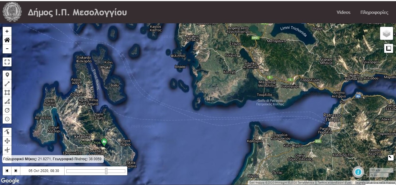
Triton WebGIS observatory platform
A new WebGIS observatory platform was designed, developed and implemented within the framework of TRITON Project, covering the coastal zone Messolonghi Municipality in Western Greece.
The tool is tailored for decision-making, risk assessment and emergency preparation and response in coastal areas. The webGIS system collects environmental, meteorological, oceanographic, hydrographic, hydrological dynamic spatio-temporally-varying data, combined with static data on land-use, geology, topography, erosion/accretion rates, seagrass abundance, etc.
All datasets were retrieved from external platforms and data providers like NOAA, Copernicus Marine Environmental Service, Corine, etc.
The system is capable of processing and visualizing these data in real-time mode.
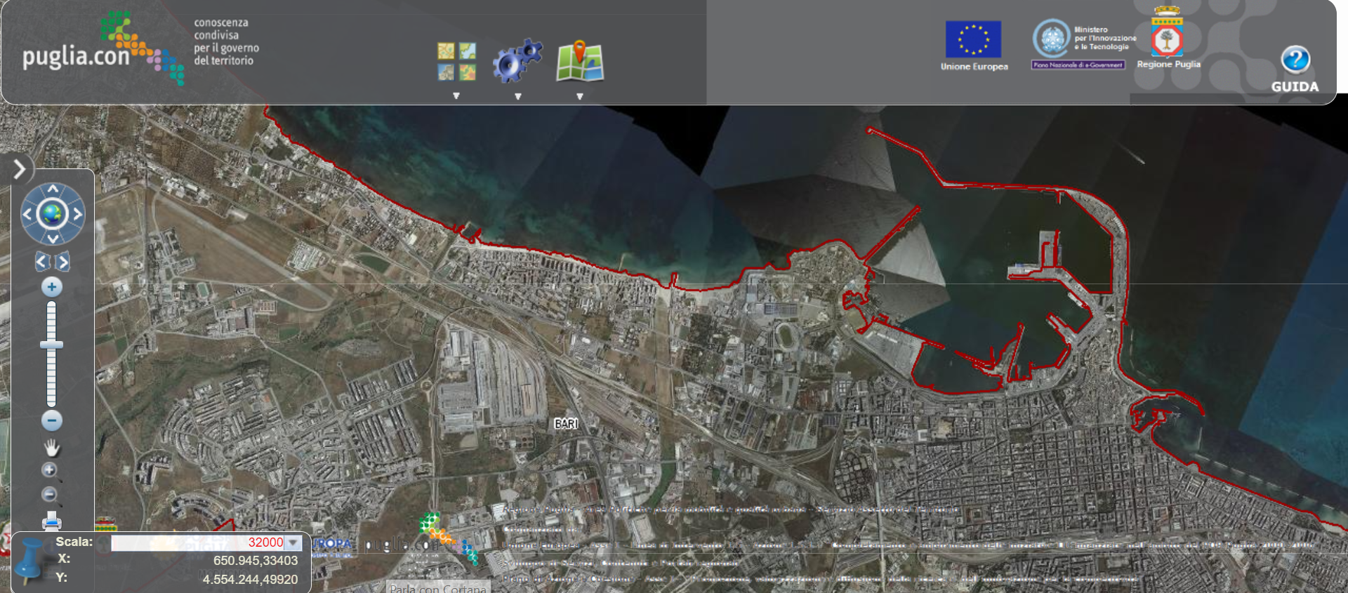
Apulia Region Territorial Information System (SIT)
The various Apulia Region branches acting in the territorial government promote the dissemination of a shared and certified knowledge base of the territory and its dynamics of transformation, necessary to guarantee effective decision-making processes, supporting the local authorithies and professionals activities and the knowledge and transparency needs of Apulian citizens.
It is built in an integrated manner, managed and made available through an Information System which is at the same time an access portal both to the territorial database and its continuous updates and to services.
Technical studies
Triton project encompasses two technical work packages, with the aim of:
- mapping of existing tools and frameworks for coastal erosion risk assessment, environmental and administrative performance
- planning for suitable indicators and decision support tools useful to characterize and quantify different elements at risk (i.e. beaches, wetlands, ports, agriculture, infrastructures, tourism, biodiversity) thus to identify pilot areas
- analysing pilot cases on WEB GIS/SIT and studying sea-water quality, climate change impacts, mapping and prioritization of coastal erosion risk in selected areas in Western Greece and Apulia Region.
WP3 presentation summarizes the mapping of existing tools and frameworks for coastal erosion risk assessment, environmental and administrative performance identifying suitable indicators and decision support tools useful to characterize and quantify different elements at risk and risk management strategies in pilot areas.
WP4 presentation involves an integrated coastal management on the Italian and the Greek side of the Programme areas with the use of pilot study areas in both countries. On the Greek side, Region of Western Greece, pilot study areas include the gulf of Patras “built” as a model observatory of coastal erosion and the Kotychi Lagoon. On the Italian side, Apulia region, the pilot study areas include the Municipality of Bari as well as the Municipality of Ugento as best practices in coastal management.
Video: Geografic Information System (PPGIS)
Training materials
Triton project offered a training path, both in Italy and Greece, to raise the awareness for Coastal Zone Management and land uses. It was divided in an International Summer School “Sustainable management of coastal heritage and actions to mitigate coastal erosion” and two cycles of local training days, held in Apulia and Western Greece Region.
The training programme was addressed mainly to public administration’s managers and experts involved in coastal management, among engineers, architects, lawyers, geologists, but also to scientists, active citizens as well as the political and technical staff of the local municipalities.
Some of the training materials are collected and available here.
Good practices
A list of examples of real-world “good practices” and recommended key references for further information and details is provided. It is a selection of projects based on the scheme of problems/possible solutions in order to achieve an integrated approach to coastal planning. They can be entire projects or only aspects of a project, and typically they encompass several steps or phases of activities.